HumanureMap Goes National: 11 States, 51,000 Sites
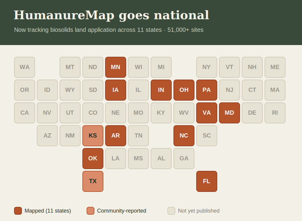
When this map started, it covered one state. Today it covers eleven.
HumanureMap now plots more than 51,000 biosolids land application sites the places where treated sewage sludge is spread on farmland and open ground across Oklahoma, Arkansas, Ohio, Virginia, Pennsylvania, Indiana, North Carolina, Maryland, Minnesota, Iowa, and Florida. Every point comes from official state environmental data: permit records, application-field boundaries, and site registrations published by each state's own agencies.
What we added
Over the past stretch, we pulled and mapped site-level data from every state that publishes it in a usable form:
- Ohio — 16,600 application fields, including which had complaints filed against them
- Indiana — 10,600 permitted sites
- Virginia — 9,300 permitted fields
- Minnesota — 6,200 biosolids sites (filtered out of a larger dataset that mixes in manure and industrial waste)
- North Carolina — 4,500 residual-solids fields
- Pennsylvania — 1,100 beneficial-land-use sites
- Iowa — 650 sites, with something no other state offers: a year-by-year record of when biosolids were applied, going back to 2018
- Florida — 700 residuals application sites, most of them now inactive
- Maryland, Arkansas, Oklahoma — rounding out the coverage
A note on Florida: nearly all of its sites are marked "inactive." We map them anyway, at full weight, because an expired permit doesn't remove what was already spread on the land. If human waste went onto a field, that field belongs on this map — whether the paperwork is still current or not.
The states that won't tell you
Building this map turned into an unplanned survey of how open or closed each state is about where sewage sludge ends up.
The answer is stark.
Only eleven states publish this as data you can actually map. A handful more have the information but keep it locked in PDF permit lists or paper files you have to request one at a time: Texas, Louisiana, Mississippi, Alabama, Washington, Wisconsin, among them. And some states don't track it at all. Kansas handed its sludge-tracking program back to the federal government in 2012; the single Kansas point on this map is one that a resident reported to us, and it is, quite literally, more than the state itself makes public.
The empty spaces on this map aren't gaps in our effort. They're the shape of what a lot of states would rather you didn't see.
Keeping it current
The nine states with open data feeds now refresh automatically every month, so the map stays current as agencies add and update sites — and nothing is ever removed. Once a location is documented, it stays.
Know of a spread site we don't have especially in a state that doesn't publish this? Use the Report a location button. Community reports are how the blank spaces start to fill in.