HumanureMap is free to use. It is not free to make.
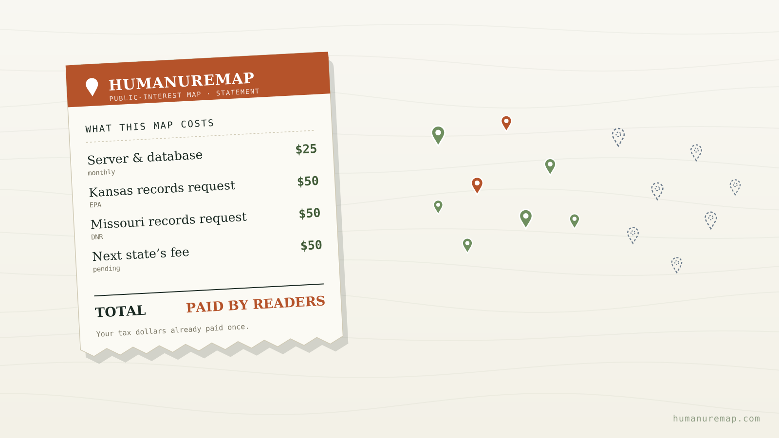
There are no paywalls here and there never will be. Anyone can open the map, filter to their state, and see where treated sewage sludge has been spread on the land around them. But keeping that map online, accurate, and growing costs real money — and lately, the biggest cost is the one the states themselves create.
The server
More than 53,000 sites across fifteen states have to load fast on a phone in a rural county with one bar of signal. That means a server that stays up, a database that stays quick, and monthly bills that come whether anyone donates or not. The nine states with open data feeds refresh automatically every month, which keeps the map current without manual work — but the machine it runs on still has to be paid for.
The expensive part: prying public records loose
Here's the part most people don't see. Every state we've added recently — Tennessee, New York, California — publishes its biosolids data openly, and those cost nothing but time. But we've mapped nearly every state that does that. The rest keep the exact same public records locked inside permit systems that only a formal records request can open.
So we file them. There are already requests in at the EPA for Kansas and the Department of Natural Resources for Missouri, with more drafted for Georgia, Alabama, Mississippi, Kentucky, the Carolinas, and beyond. And here's the catch that makes this a fundraising post instead of just a status update: these requests cost money. Under most open-records laws, a state can charge for the staff time to search and the cost to copy. Some will hand over a clean data file for free. Others quote a fee before they release a single page — and we have to decide whether the public's right to know is worth the bill.
Think about what that means. Your tax dollars already paid to collect this data. The state already has it. And to put it in front of the public, a small independent project has to pay the government a second time to pry loose records that were public all along. We think that's backwards. We also think it's worth doing anyway.
Why there aren't more ads
You've probably noticed the map carries a banner or two from local businesses. Those ads help, and we're grateful for them. But we keep them small and few on purpose — this is a public-interest map, not a billboard, and we'd rather it stay fast, clean, and beholden to no one. That independence is only possible if the people who use the map help keep it running.
How you can help
If this map has shown you something you needed to know — about your county, your water, your farm, the field next door — here's how you can keep it going and growing:
Chip in. Every dollar goes to the two things that actually move this forward: the server that keeps the map online, and the records-request fees that unlock the next state. A single donation can cover the fee for an entire state's data. Support HumanureMap →
Report a location. Know of a spread site we don't have? The Report a location button is how the map fills in the places official data misses — and it's completely free.
Spread the word. Share the map with a neighbor, a county commissioner, a reporter. The more people who can see where this is happening, the harder it is to keep quiet.
The blank spaces on this map aren't gaps in our effort. They're the shape of what some states would rather you not see. With your help, we'll keep filling them in — one server bill, and one records request, at a time.