Texas Makes Twelve
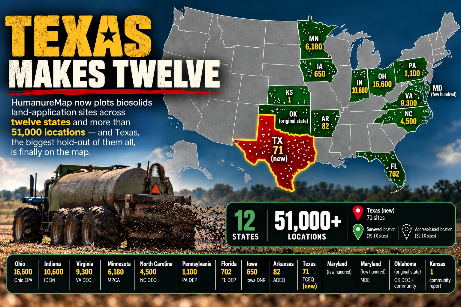
Last time we wrote, Texas was on the other list — one of the states that keep their sewage-sludge records offline, behind a paper request, out of public view. Today Texas is on the map.
HumanureMap now plots biosolids land-application sites across twelve states and more than 51,000 locations, and Texas — the biggest hold-out of them all — is finally one of them.
How Texas got on the map
Texas doesn't publish its biosolids sites as data you can download. There's no map layer, no open feed — just a registry of permit holders and, if you ask for it, a records request. So we asked.
A public-information request to the Texas Commission on Environmental Quality (TCEQ) for Class B sludge land-application sites came back with something the state's own website never shows: 39 permitted sites with surveyed field coordinates — Synagro's sprawling Kaechele Ranch in Colorado County (52 fields, 5,400+ acres), the City of Austin's Hornsby Bend plant, cities from Midland to Eagle Pass to the Rio Grande Valley. These are the gold-standard points: real, mapped, verified.
Then we went further. TCEQ's Central Registry lists roughly 2,250 entities tied to the sludge program — but the overwhelming majority are septic haulers, pump trucks, and service companies, not places anything gets spread. We filtered that list down to the actual application sites and ranches, dropped the ones already covered by the records request, and geocoded their registered street addresses. That added 32 more sites, placing them by address rather than by survey.
Texas now stands at 71 mapped sites.
What's solid and what's approximate
We think it matters to be straight about this. The 39 records-request sites are plotted at their true, surveyed locations and show as solid pins. The 32 registry sites are plotted from their registered street address — which is sometimes the field itself and sometimes the operator's office — and show as dashed pins, with the real address printed in every popup so you can see exactly what the point is based on.
We also left some out on purpose. A dozen more Texas sites sit on rural farm-road addresses — "County Road 272," "FM 534" — that no geocoder can resolve to an actual point. Rather than drop them in the middle of a town and pretend that's precise, we held them back. If TCEQ ever releases a full coordinate dataset, they go on properly.
Why this one mattered
Texas is the proof that the closed states can be opened. The information exists; it's just not handed out. It took a formal records request and a lot of cleanup to turn a registry of permit numbers into points on a map — but it worked, and the same approach works for the others still missing: Louisiana, Mississippi, Alabama, Washington, Wisconsin.
The blank spaces on this map were never about our effort. They're about what each state chooses to make easy to see. Texas just got a little harder to keep in the dark.
Know of a spread site we don't have? Use the Report a location button — community reports are how the rest of the map fills in.